
Mount Gambier Walks
Walking is the most simple, yet most memorable way to experience a place. In Mount Gambier, we excel in offering the best of walking experiences. The type of walks that engage all of your senses. To walk the Mount Gambier local region, you can take a meander or push your endurance level with something more challenging. If it is history and culture, we offer walking trails in the city. For those who like to ramble enjoy any number of walks through the stunning Crater Lakes area.
It doesn’t matter what your fitness level is or the special interest area you may have, Mount Gambier and the Limestone Coast will not disappoint.

Walk the City
Compact and cosmopolitan with a cultural buzz, Mount Gambier is a wonderfully walkable city, and there are trails to cater for all interests, from significant artworks to night lights and local history.
A self-guided walking tour visits 32 heritage buildings with distinctive bollards containing information about each site, while the inner-city Rail Lands have become a recreational hotspot after an abandoned railway line was converted to a shared walking and cycling path stretching for more than 3kms.

Walk the Region
When visiting Mount Gambier region you can be sure that you will have moments that simply take your breath-away. The forests, coast and parklands all offer those who love to “Stretch Their Legs” rewarding and inspiring experiences.


Crater Lakes Walks
Right in the heart of Mount Gambier is the Crater Lakes, an area with numerous walks offering an array of views and experiences. You can zig-zag from track to track, walk the dog, take the kids or take some time out alone. Of course, you can take a run too if that suits you more.
Allow plenty of time to explore the beautiful Crater Lakes areas. It is full of surprises. From fascinating geological beginnings to the heritage story of Mount Gambier and the flora and fauna to take in, there is plenty to enjoy.
The Crater Lakes offers numerous trails for exploring and amazing views of the region. These are a few, but the opportunities to ramble along many paths will provides you a plethora of choice.
This walk is well worth allowing time for. The walk takes you around the perimeter of the Blue Lake/Warwar with many points of interest along the way. Parking adjacent the Apex Lookout to begin your journey.
Along the way you can enjoy views from a number of lookouts. Check out the Gordon Monument, a granite obelisk built to commemorate Adam Lindsay Gordon for both his talents as a poet and for his famous leap on horseback, in July 1864 (head to the walk to learn more!). Head under the tunnel and marvel at the Pumping Station, still delivering water to Mount Gambier.
Distance: 3.6 kms / Time: 1.5 hours / Grade: Easy
This walk provides magnificent views over this very unique landscape. Begin this walk at Mark’s Lookout, Lions Lookout, or Rotary Clubs Lookout (Potters Point Lookout). Follow the track in an anti-clockwise direction. This walk is not pathed and does involve stairs, inclines, and uneven grounds.
Distance: 4.2 kms / Time: 2 hours / Grade: Moderate
This area is ideal for short walks, at any time of year. In summer the area is cool, in Autumn the amazing colour of the deciduous trees, in winter it is stark but invigorating and spring brings a striking array of build at the northern end. Take your camera and capture the natural beauty of the region.
Distance: 1.6 kms / Time: 1 hours / Grade: Easy to moderate
The Centenary Tower commemorates the naming of Mount Gambier by Lieutenant James Grant in December 1800. Grant undertook the first eastwards passage along the southern coast of Australia in the HMS Lady Nelson. He sighted and named Gambier’s Mountain (Mount Gambier) from the deck of his ship.
This walk starts at the tunnel under the road and takes you up steps to the “rest house” on to the Stephen Henty Lookout and then the Hoo Hoo Lookout. There are markers along the way.
This is an important site for Mount Gambier as a community. On November 27, 1918 the Mount Gambier community came together for the largest working bee on local record. Over 2000 people participated in the project, 300 of those were “lady caterers”.
They constructed most of the wall and walk now known as Rook Walk.
Distance: 1.7km / Time: 1 hour / Grade: Easy to moderate
If you’re into wildlife, this is the walk for you! Once you enter the Conservation Park, you can follow the tracks to explore the park and the native flora and fauna. Birdlife can be seen from the raised boardwalk and bird hides, providing a closer look at the bushland canopy and views over the park. Keep an eye out for other animals, including Koalas, Kangaroos, and Echidnas. Don’t forget your camera on this walk!
Distance: 1.2 kms / Time: 45 minutes / Grade: Easy
Best way to SEE the world
…is on foot.
Step Back in Time & Follow the City Heritage Walk
Walk the Historic Buildings of Mount Gambier that Date Back to 1863.
Follow along on the digital map below and see old pics, interesting facts about the buildings and more…
Best way to EXPLORE the world
…is on foot.
Mount Gambier Regional Walks
Just a few minutes out of town, you can experience natural wonders with a variety of short and long walks to suit all ages and abilities.
What a beauty! Such a treasure! You will need a reasonable fitness level, but it is very worthwhile. Parking at the base of the mountain you ascend up a track for approx. 20 minutes to the crater rim. As you climb, it is usual to share the track with the resident wallabies. Once at the top, glorious views are there to greet you, with a 360 degree vista looking as far as the Coast. Take a seat and take it all in. If you have made the climb in the morning, you may have the privilege of watching the pair of black wedge-tail eagles catching the updraughts as they start their day of hunting.
You can also stare down into the crater, but better still take the well-defined pathway, a 20-30 minute walk into the crater itself. Take care on your descent, but it is well worth it. You may spot Billy the Goat, a Mount Schank resident who can often be seen grazing on inside the crater wall.
Once at the bottom the photo opportunity is all yours. A tradition of the locals is to make the letter of your first name from the rocks. Then back at the top again you can see it and, yes, another photo opportunity!
You can’t beat a walk in the Wetlands, be sure to take your camera and binoculars. The Bool and Hacks Lagoons are Ramsar sites. Bool Lagoon is one of the largest and most diverse freshwater lagoon systems in southern Australia. This seasonal wetland is home to a wide range of wildlife and provides essential drought refuge for many rare and endangered bird species.
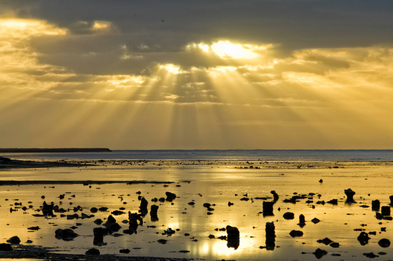
Port MacDonnell is a seaside town with a proud history of seafaring. It has been home to generations of lobster fishing families and the coast is the location of tragic shipwrecks, such as the Admella.
The walk along the foreshore, is an easy walk of 2.4kms. Starting at the jetty and walking to the end of the cycle/walk track. From this point, it is a further 900 metres ascent on the roadway up to the cliffs to commence the walk up to Northumberland Point with its spectacular views up and down the coast. You may take a short diversion to the lighthouse on your way.
This is a walk that demands a camera as it will be memorable.
The Germain Reserve is a 55 hectare reserve with a network of walks. Established in 1978 and expanded in 1995. The reserve was named after Cape Northumberland’s first lighthouse keeper Ben Germain. Enjoy a choice of walks from easy to moderate, with distances from 750 meters to 2km (return trip) through bushland with an array of unique flora and fauna.
Best way to FEEL the world
…is bare foot.
Mount Gambier Cycling
If you love to ride, Mount Gambier and its regions offers everything from road cycling, off-road, leisure cycling or just a cruisy way to get around.
Cycle the Region
With so much to explore, you can roll around on your own. Or the local Mount Gambier Cycling and Triathlon Club is active and always welcomes visitors to join their rides.
Free Bikes: The City of Mount Gambier provides free bike hire, available at the Mount Gambier Visitor Centre, Riddoch Arts and Cultural Centre, and the Mount Gambier Library.
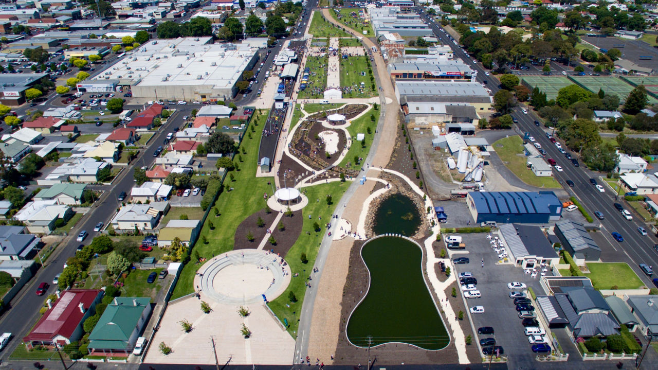 The Mount Gambier Rail Trail follows the old railway line through the centre of the City.
The trail is used by cyclists, walkers and runners of all ages, and is a popular choice for travelling from one side of the City to the other, or just for recreation.
Total Length: 12.4km
 Ride or walk along the foreshore, is an easy ride of 2.4 kms.
Starting at the jetty and walking to the end of the cycle/walk track.
From this point, it is a further 900 metres ascent on the roadway up to the cliffs to commence the walk up to Northumberland Point with its spectacular views up and down the coast.
Consider a small 5 minute deviation walk to the Port MacDonnell Maritime Museum.
Uncover the stories behind Port MacDonnell; once the state’s second largest trading port. Discover how over 30 ill-fated ships came to grief along the rugged local coast.
 This is an area not to be missed for those who love to learn about destinations as they cycle on their holidays.
The rides of the region begin in Penola, a 30 minute drive from the heart of Mount Gambier. The trails include the Heritage, Penola, Shiraz, Conservation Park, Red Gum & Winery, Kalangadoo & Nangwarry, Yallum Park and Bool Lagoon.
Information is available at the local visitors centre or download the brochure and map to start planning a memorable day of riding.